Explore England’s Green Belt with our interactive map. Instantly discover if your site falls within protected areas by entering your postcode. Our comprehensive tool covers all local authorities, providing valuable insights for planners, developers, and homeowners.
Understanding the Green Belt in 2025
The Green Belt is a crucial part of England’s landscape, covering approximately 13% of the country. Established to prevent urban sprawl, preserve the character of existing settlements, and encourage development within built-up areas, the Green Belt plays a vital role in shaping our communities. Our interactive map helps you navigate these protected areas, offering essential information for your planning and development needs.
Our Architectural Projects
At A9 Architecture, our projects serve as a testament to our commitment to bringing architectural visions to life. Each endeavour highlights our expertise and the unique solutions we provide to meet our clients’ goals. From bespoke residential designs and innovative commercial spaces to functional outbuildings and vibrant public areas, our diverse portfolio showcases the breadth of our work. We take pride in our meticulous attention to detail and dedication to quality, ensuring that every project not only meets but exceeds expectations. Explore our projects to see how we have brought architectural visions to life. Each project highlights our expertise and the unique solutions we provide to meet client goals. These examples showcase our diverse range of work and commitment to quality.

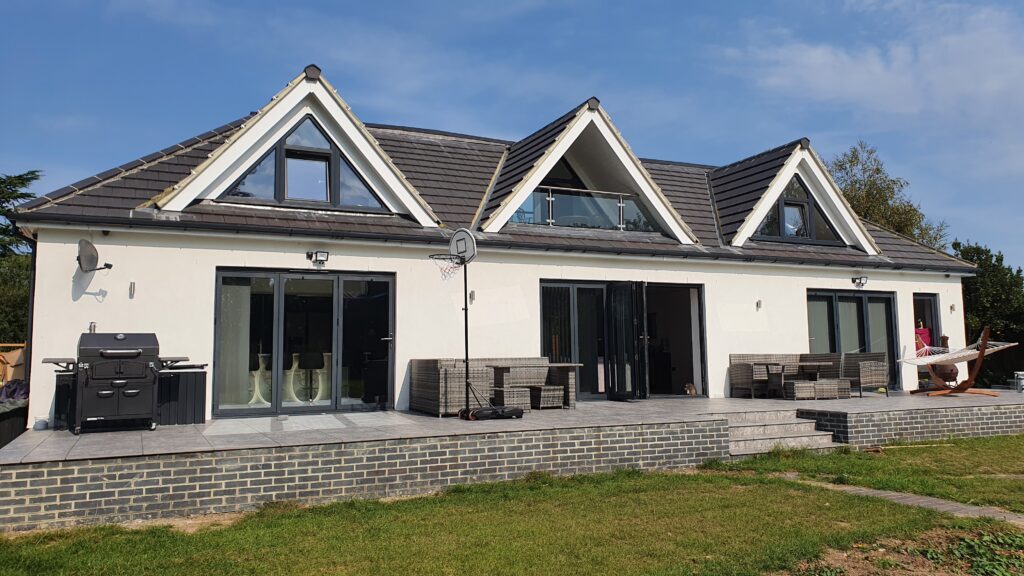
This one off-off dwelling combines luxury with modern design. Clean lines and a wealth of accommodation, this is the very high end of residential living. The master site is reminiscent of a 5-star hotel, combined with the split-level open plan living, swimming pool/gym and the secret jacuzzi area the dwelling is designed so you just won’t want to leave.
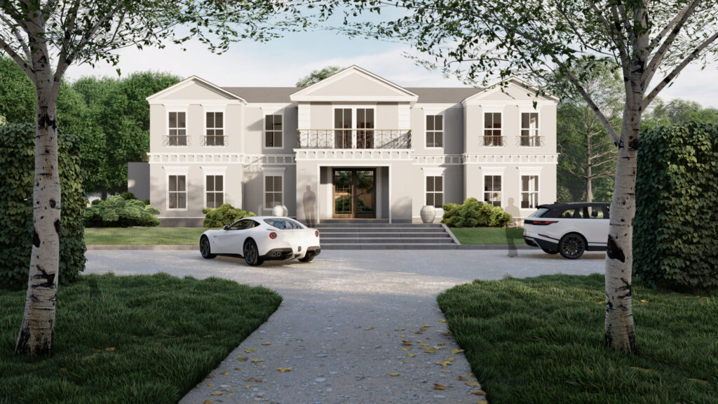
The property is set back from the main road, approx.147 metres from Broomwood Lane. The Old Manor is located in quiet locality with 1 neighbours’ property, which is three story residential dwelling. The Old Manor has an area of 10799.25 m2 and is located in green belt.
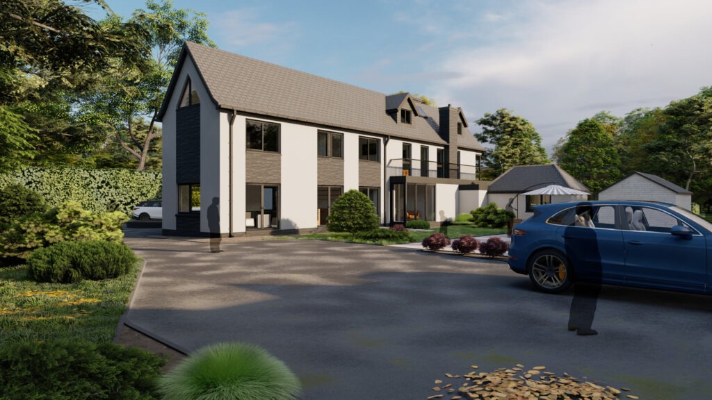
The intention is to create 6-bedroom 2 storey property with 3 gables and balcony to the front elevation and single-storey rear wrap-around with central courtyard and landscaping on the site.
The proposed design achieves Georgian period architecture to the front & flank elevations of the two-storey element and a contemporary style to the single-storey rear.
Awaiting Content Information
he site is situated within the settlement boundary of Billericay. The area is inherently residential in character with a diverse mix of residential properties within the same street scene.
The proposed application seeks the approval to create a single storey dwelling within a pitched roof over to the rear of 262 Outwood Common Road. The proposed site would have an area of 462.2m2 which would achieve off road parking of 183.3m2, front amenity space of 45.3m2, a rear amenity space of 113.6m2 and a proposed footprint of 86.8m2.
The dwelling would then achieve an enclosed front amenity space which would provide access to the dwelling front door that is located centrally. The rear amenity space is then located within the north of the site which would also be enclosed by a public footpath and natural woodland.
The front entrance is location of the north elevation centrally within the property. On entering the property an open plan kitchen, dining and social living area is located to the south east section of the dwelling. This would have a set of bi-fold doors located to the north east elevation leading out onto the private amenity space. The dining area and kitchen will be located centrally and to the south east section on the building with combined floor area achieving 30 m2. The family bathroom would achieve disabled standards and be located adjacent the existing kitchen 8 containing all the utility in one area of the proposed dwelling. A corridor to the south elevation of the dwelling will the provided access to the two proposed bedrooms. High level windows will be located to the south elevation providing natural light and ventilation when desired. A double bedrooms will then be located onto the north west elevation of the site achieving a floor area of 15.6 m2 with a windows overlooking the front amenity space. The second bedroom is to be a single with a proposed floor area of 9.1m2.
The surrounding context comprises of two storey dwelling with an approximate ridge height of 8.5 metres. However the site is located at the lowest point within the surrounding context. The proposed ridge height of the dwelling is to be 4.6 metres in height with an eaves height of 2.8 metres.
Outwood Common Road comprises of a variation of material with the prominent being facing brick. In addition to the facing brick, render, cladding and hanging tiles with interlocking roof tiles. The surrounding driveways are made of concrete, tar mac, permeable paving or unbonded materials.
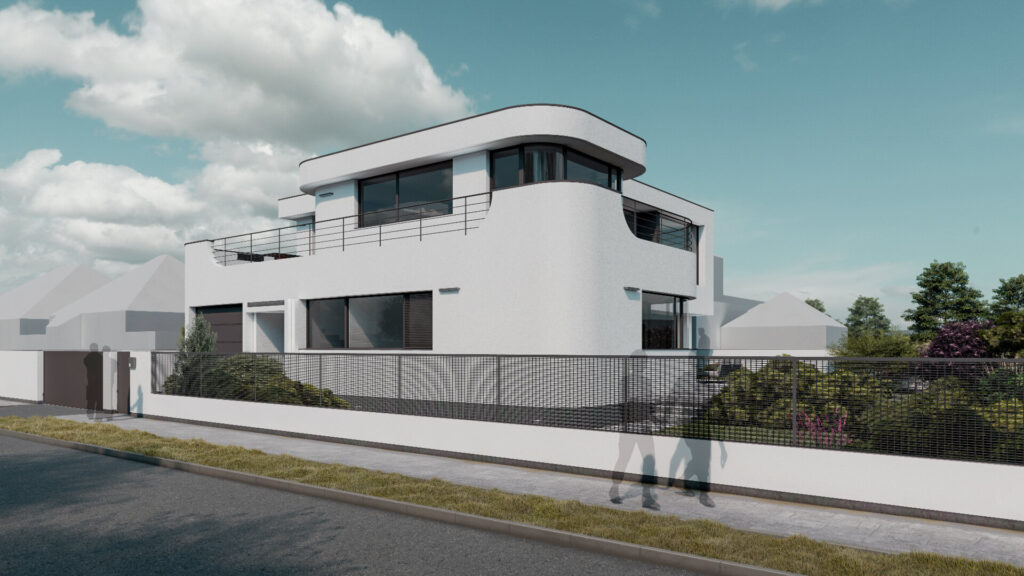
Designed in an Art Deco style, this one-off dwelling takes advantage of its prominent Seafront location. A blend of modern living internally, with a period style externally. The local modernist examples were inspiration to revive this truly amazing architectural period.
Awaiting Content Information
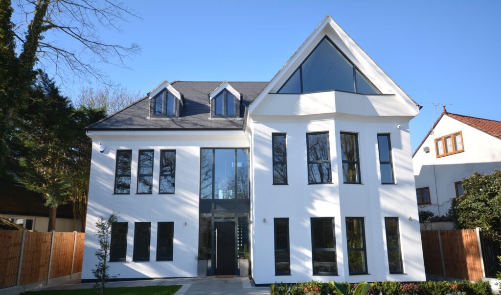
Two Storey Extension, Internal Alterations, Creation of Second Floor Within New Roof Space & Creation of Triple Garage Outbuilding
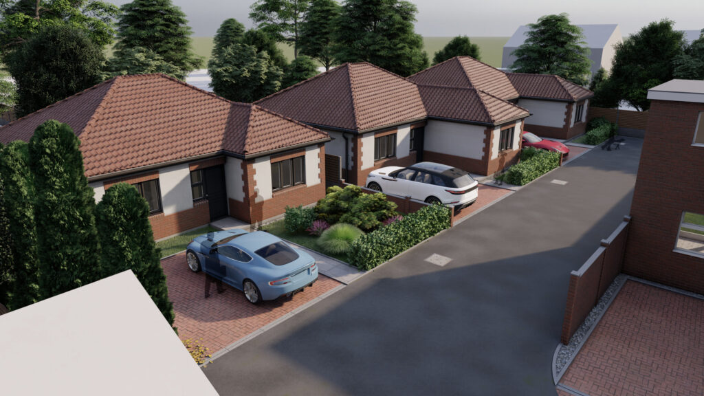
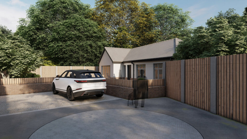
The application relates to a roughly rectangular piece of land having dimensions of approximately 35m by 28m. A concreted strip of vehicular access is available from Rosemead which provides access to six dwellings including no.15 of which the application site currently forms part.
Permission is sought for the removal of the garage block and the erection of three detached bungalows. These would have an overall height of approximately 5.4m and a mixture of brick, render and clay roof tiles as the external materials.
Awaiting Content Information
Extraordinary Design by A9
Salient
by ThemeNectar
Contact A9 Architecture to Get Started
Contact us today and take the first step towards transforming your ideas into a stunning architectural design. We are here to support you every step of the way. For a free consultation, please reach out to us; we are ready to discuss your project and answer any questions. Let us help you create a space that reflects your style and meets your needs.
Green Belt FAQs
What is Green Belt land?
Green Belt is a designated area of protected land around urban areas, designed to prevent urban sprawl and preserve open spaces. It covers approximately 13% of England’s land area
Can development occur on Green Belt land?
While there’s a general presumption against development in Green Belt areas, exceptions can be made under “very special circumstances” or for specific types of development, such as agricultural buildings or limited affordable housing
How much Green Belt land is there in England?
As of March 31, 2024, there are approximately 1,634,760 hectares of Green Belt land in England
Has the amount of Green Belt land changed recently?
Yes, there was a decrease of 3,540 hectares (0.2%) in the area of land designated as Green Belt between March 31, 2023, and March 31, 2024
What are the main purposes of Green Belt land?
The Green Belt serves five main purposes: preventing urban sprawl, stopping neighbouring towns from merging, safeguarding the countryside from encroachment, preserving the setting of historic towns, and assisting in urban regeneration